
Nowadays there is growing popularity of 3D objects. It is so due to the maximum visibility of geospatial data and the completely new functional and informational capabilities that modern IT technologies provide, if compared to 2D maps and diagrams.

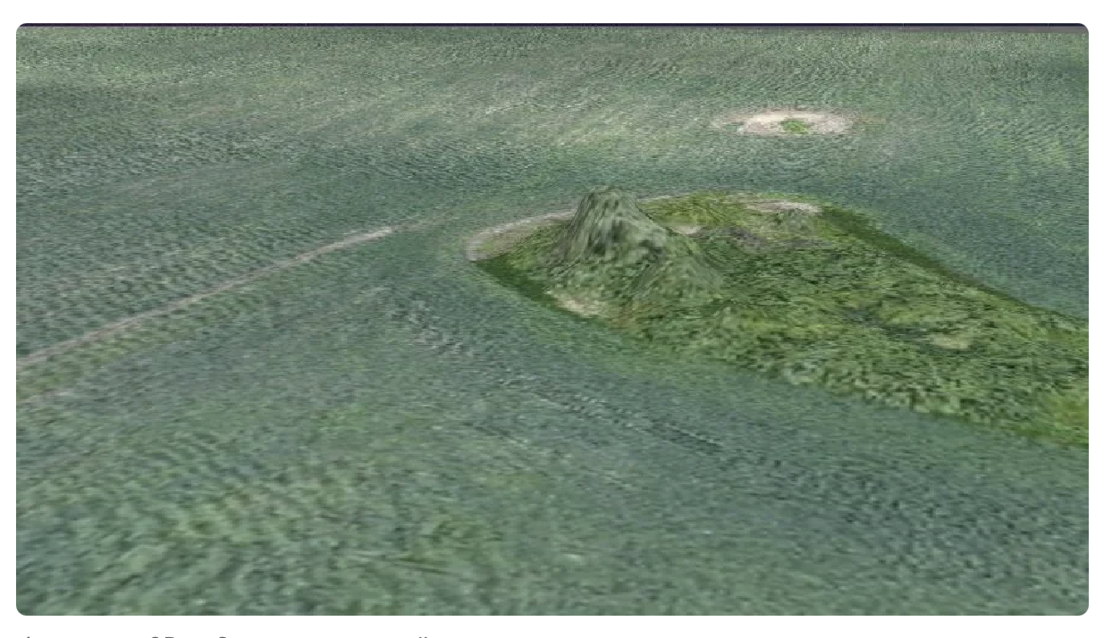
The figure shows three types of maps:
1 - 2D orthophotomap;
2 - 2D heightmap;
3 - 3D map.
The third type of maps gives an opportunity to get dimensional visual analysis of the relief, which makes it possible to understand the configuration of land resources.
The relief of agricultural fields plays an important role in crop production. So, the size and direction of the slopes of the terrain affects the choice of crops for growing, the organization of anti-erosion measures, the use of special methods for performing agricultural work and other special features of agricultural production circle.
The three-dimensional representation of the farmland relief allows the holding management to assess the whole picture of the land "as it is" in a simple and visual form, as close to reality as possible. 3D representation of the relief is also relevant in the farmland market when large areas of land are purchased or sold, when it is necessary to assess and clarify the features of the relief. 3D terrain is easier to understand and assess than 2D height and slope maps. Besides, there is an opportunity to view the relief on many sides.
Measuring the angle of the slopes allows forming the structure of sown areas correctly, taking the agro-ecological requirements for crop rotation into account. So, for the sound management of arable land and prevention of soil washout, these requirements are separated according to the accepted characteristics of the slope gradients: intensive, moderate or limited use of land areas. For example, the agrolandscapes of the East-European Central Non-Black Earth Region are divided into the following groups according to the degree of soil erosion (washout):
- Non-eroded or slightly eroded arable land of the universal use, located on the slopes with a gradient of up to 3°. Its relief and soil-agrochemical characteristics make it possible to cultivate all standard crops. An intensive use of arable land is possible on unwashed soils, where slopes do not exceed 1°.
- Land areas with a slope gradient of 3 ° to 5 ° with medium and weakly eroded soils. They are used for perennial grasses and crops of continuous sowing with an average soil-protecting function: winter, spring grain and leguminous crops, annual grasses. Intertilled culture is excluded.
- Lands with a slope gradient of 5-8 °, mainly with medium- and strongly eroded soils, which require special soil-protective use. They are used for growing perennial and annual grasses, cereals with medium and high soil conservation efficiency. Perennial grasses in the structure of the sown area should contain at least 50%. When cultivating, agrarians usually use special technological methods and machines.
- Slopes with a gradient of more than 8 ° with physicochemical properties unsatisfactory for most crops. This group also includes agrolandscapes with the relief, full of narrow shallow gullies as well as the relief with short gradient slopes of various types. These lands are excluded from active agricultural direction and are used for other agricultural purposes – for hayfields, range areas. The structure of sown areas is formed taking these principles into account. Besides, the system of rational types of crop rotation is used according to the structure of the cultivated areas, the degree of development of erosion processes, the type and gradient of slopes.
Thus, information on the slope gradient allows improving the structure of sown areas, as well as the system of crop rotation, which plays an important role in the anti-erosion measures taken for the land areas.
Determining the direction of slopes in each specific field or its section is an important stage in the organization of soil cultivation, since the correct choice of direction allows increasing the work productivity and protecting the land from erosion. The plowing direction is chosen according to the previous plowing activity, size, configuration and relief of the field. Recommended directions: across the previous plowing area, across the slopes in order to fight against water erosion. In this case, plowing across the slope with a gradient of 1-1.5 ° and more does not present any difficulty. However, if the fields have slopes of different directions, the plowing activity should be carried out horizontally (if possible). Otherwise, such fields should be divided into parts and cultivated independently according to each slope:
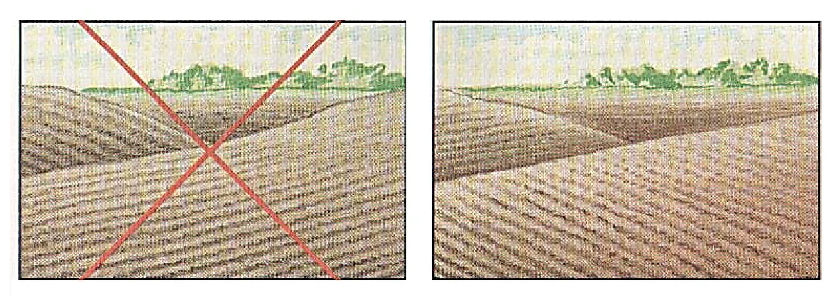
The three-dimensional representation of the relief using 3D models of farmland will provide a visual picture of the direction and nature of the slopes on the cultivated area without being in the fields. Moreover, it can serve as the basis for planning soil tillage activity. According to the studies of East-European Research Institute of Agriculture, plowing along the slope washed away 24.3 cubic meters of soil from 1 ha, and the plowing process across the slope washed away 2,9 cubic meters. Due to cross plowing, the water supply increased by 150 tons per hectare in the meter soil layer, and the increase in grain yield was 2 centners per hectare.
Information on slope directions is also used to estimate surface runoff and soil moisture. Terrain characteristics also affect the calculation of the field area. The size of a land plot on 2D maps is usually shown as a geodetic area calculated by projecting the boundaries of the land plot onto a horizontal plane. In the picture below, the geodetic area is highlighted in green. The physical area of the land plot is calculated according to the unevenness of the earth's surface (slopes, hollows, gulleys, etc.). In the figure the boundaries of the physical area are highlighted in black.

Differences in the areas of land plots on slopes and in projection can reach 10%. Accordingly, the actual costs for cultivating the land, the amount of planting material, etc. increase in comparison with the planned ones. Thus, the use of 3D models of farmland provides agricultural specialists with the necessary information for:
- improving the structure of sown areas;
- protection of lands from erosion and the formation of gulleys on the slopes by determining the optimal method and direction of plowing the slopes;
- organizing forest belts to protect agricultural land from excessive solar radiation, heavy snowfalls, wind erosion of soil;
- more accurate calculation of the real area of agricultural land to optimize the amount of seeds, fertilizers and plant protection products.